3ème correction du Rhône
Canton of Vaud, Switzerland
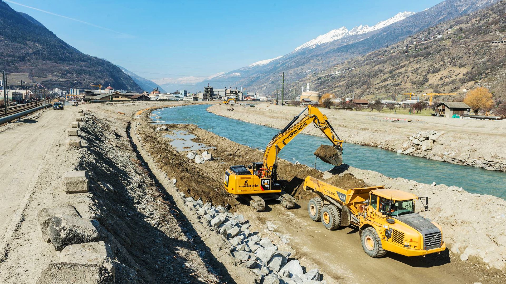
Hydraulics: Watercourse development.
Project
- Determination of the water levels of the future enlargement of the Rhone for different return periods with the HEC-RAS model. Hydraulic and static design of the new dikes.
- Definition of the type of bank protection (groins, riprap).
- Design of a submersible dike to drain part of the water through a defined corridor and thus reduce the risk of dike failure during extreme floods.
- New road concept following the relocation of the road from the dike to the right bank.
- Project to relocate existing underground pipelines.
- Replacement of the existing biotope by a new biotope outside the future Rhône dike.
- Renaturation of the canals of the plain.
- Evaluation of the environmental impacts of the project.
- Phasing of work, materials management and quotations.
Technical data
- Length of intervention: 2.1 km
- Widening of the Rhone to its speed width of 60 m (initial width: 30 m).
- New dike on the right bank. Height of the new dike: 4 - 5 m
- Raising the existing dike on the left bank by about 1 m.
- Protection of the riverbanks by groins or riprap depending on the area.
- Bank slope: 1: 5: 5 - 1: 2
- New submersible dike on the right bank with an erodible upper layer thickness of ~ 1 m (this layer erodes as soon as the water level corresponding to Q1000 is reached).
- Realization of a Ramp: Length: 100 m; gradient: 3%.
Total cost
CHF 30 Mio.
Timeline
2012–2013
Customer
Canton VS – SRTCE – Section Rhône 3
Datum: 25.01.2019
/www.pini.group/de/pini/banners/0/content/0/image/PG_web_joinus.png.png)
/www.pini.group/de/pini/banners/0/content/00/image/PG_web_findus.png.png)